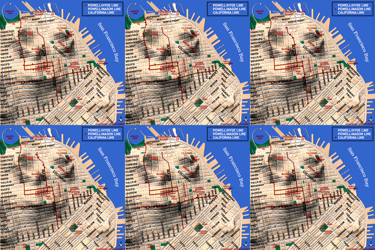
A map of San Francisco and it's historic cable car lines.

|
Basically, there are three cable car routes in operation, and it helps to know their respective destinations. At Powell and Market streets, there is a cable car turntable which serves as the beginning stop for two lines, the Powell-Mason and Powell- Hyde lines. The Powell-Mason line begins at the Powell/ Market turntable, and the line runs from there up and over Nob Hill and down to Bay Street at Fisherman's Wharf. The Powell-Hyde line also begins at the Powell Market turntable and runs over Nob and Russian hills before ending at Aquatic Park near Ghiradelli Square. Both these lines end near Fisherman's Wharf, but at different areas, and the routes are significantly different. Paying close attention to the signs on the cable cars will help you distinguish where in Fisherman's Wharf you will find yourself. The California Street line runs East-West from the Financial District, through Chinatown, over Nob Hill and stops at Van Ness Avenue. Since all the cars on this line have the same routes, the signs are painted directly on the car. |